| Home | Hierarchy | Members | Alphabetical | Related Pages |
#include <geocoordinate.h>
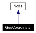
Inherits Node.
Inheritance diagram for GeoCoordinate:

Public Member Functions | |
| GeoCoordinate (const char *name="") | |
| virtual | ~GeoCoordinate () |
| virtual unsigned int | nbFields () const |
| virtual FieldHandle | field (const std::string &n) |
| virtual FieldHandle | field (const unsigned int i) |
| virtual bool | isSetToDefaultValue (const unsigned int i) const |
| virtual unsigned int | nbEventsIn () const |
| virtual EventInHandle | eventIn (const std::string &n) |
| virtual EventInHandle | eventIn (const unsigned int i) |
| virtual unsigned int | nbEventsOut () const |
| virtual EventOutHandle | eventOut (const std::string &n) |
| virtual EventOutHandle | eventOut (const unsigned int i) |
| const char * | typeName () const |
| virtual Node * | duplicate () const |
| virtual Node * | duplicate (std::map< const Node *, Node * > &) const |
Public Attributes | |
Fields | |
A property or attribute of a node. Each node type has a fixed set of fields. Fields may contain various kinds of data and one or many values. Each field has a default value. | |
| SFNode | geoOrigin |
| MFString | geoSystem |
| MFString | point |
The GeoCoordinate node specifies a list of coordinates in a spatial reference frame. It is used in the coord field of vertex-based geometry nodes including IndexedFaceSet, IndexedLineSet, and PointSet. This is an optionally-implemented VRML node that constitutes part of the VRML support for geospatial applications, see 4.15, Geospatial application support.
The geoOrigin field is used to specify a local coordinate frame for extended precision as described in 4.15.5 Dealing with high-precision coordinates.
The geoSystem field is used to define the spatial reference frame and is described in 4.15.3, Encoding a spatial reference frame.
The point string array is used to contain the actual geospatial coordinates and should be provided in a format consistent with that specified for the particular geoSystem (see 4.15.4 Encoding geospatial coordinates. The geospatial coordinates are transparently transformed into a geocentric, curved-earth representation. For example, this would allow a geographer to create a VRML world where they specify all coordinates in terms of latitude, longitude, and elevation.
![]()
|
|
Construct a node with all its fields set to default value, which is equivalent to the code below: |
|
|
Virtual destructor, does nothing |
|
|
Implements Node. |
|
|
Returns a deep copy of this node, that is a fully independant node with all children (if any) also copied. This is mainly useful for instanciating protos. Implements Node. |
|
|
Return a handle on the Implements Node. |
|
|
Return a handle on the event in named Implements Node. |
|
|
Return a handle on the Implements Node. |
|
|
Return a handle on the event out named Implements Node. |
|
|
Return a handle on the
Implements Node. |
|
|
Return a handle on the field named
Implements Node. |
|
|
Implements Node. |
|
|
Returns the number of events in for this node type. Implements Node. |
|
|
Returns the number of events out for this node type. Implements Node. |
|
|
Returns the number of fields (exposed or not) for this node type. Implements Node. |
|
|
Returns Implements Node. |
|
|
See Detailed Description for meaning of this field. Default value is set to SFNode default value |
|
|
See Detailed Description for meaning of this field. Default value is set to |
|
|
See Detailed Description for meaning of this field. Default value is set to MFString default value |
Generated on 24 Feb 2005 with
 version 1.3.9.1.
|
|